 you are not logged in


![]()
![]()
![]()
 Management, Protection and Sustainable Use of Groundwater and Soil Resources
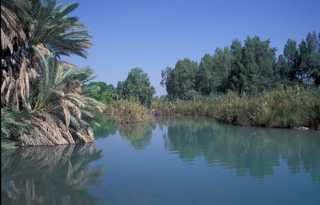
The project in its third and forth phase (April 2004 - July 2011) has the main objective of developping and making available
an efficient, inexpensive and easily sharable water planning and management tool - (Decision Support System - DSS)
in order to work together towards a more integrated water resources management in the Middle East and beyond.
Activities:
1. Establishing a data and information base
2. Developing applying a DSS-Software (WEAP21, MODFLOW2000, additional Models)
3. Application of a DSS in two pilot areas (Zabadani Basin, SYRIA and Berrechid Basin, MOROCCO)
4. Institutionalizing (including capacity building)
5. Dissemination
The Decision Support System (DSS) for Soil and Groundwater Management in the two pilot areas will give decision makers the necessary insight into the current status and the possible scenarios of the future development (population growth, agriculture development, etc.). In both pilot areas (Zabadani Basin Syria, Berrechid Basin Morocco) a water conflict between concurrent users already exists and so far no abstraction limits/ abstraction monitoring is implemented. Therefore the project aim is to collect all relevant data, get the representative water users together and jointly decide after the winter rains and the resulting calculated stored groundwater volumes by the aid of the DSS on the water shares for the current hydrologic year and future ones.
| Project number | 2004.2032.3 | ||
|---|---|---|---|
| Subject(s) | AGRICULTURE , HYDRAULICS - HYDROLOGY , MEASUREMENTS AND INSTRUMENTATION , METHTODOLOGY - STATISTICS - DECISION AID , NATURAL MEDIUM , POLICY-WATER POLICY AND WATER MANAGEMENT , PREVENTION AND NUISANCES POLLUTION , RISKS AND CLIMATOLOGY , TOOL TERMS , WATER DEMAND , WATER QUALITY | ||
| Geographical coverage | Syria, Morocco, Germany | ||
| Budget (in €) | 0 | ||
| Programme | Arab-German Technical Cooperation (BGR) | ||
| Web site | http://www.acsad-bgr.org/ | ||
| Objectives | The project's main objectives: to strengthen ACSAD's role as adviser for national institutions of the Arab region in groundwater- and soil-related issues. to develop appropriate methodological tools and guidelines for the management, protection and sustainable use of groundwater and soil resources. to disseminate the required technical know-how and raise awareness among specialists, decision makers and communities. |
||
| Results | Within the framework of the technical cooperation project “Management, Protection and Sustainable Use of Groundwater and Soil Resources” jointly carried out by the Arab Center for the Studies of Arid Zones and Dry Lands (ACSAD) and the German Federal Institute for Geosciences and Natural Resources (BGR) a Decision Support System (DSS) for water resources management was developed and applied in two pilot areas. The DSS consists of three major components, a project database, a groundwater flow model (MODFLOW2000) and a user-friendly water evaluation and planning software (WEAP, www.weap21.org). The modelling components MODFLOW and WEAP are dynamically linked so that for each time step results of one model are transferred as input data to the other. MODFLOW calculates groundwater heads, storage and flow, whereas WEAP calculates groundwater recharge, river stage, irrigation demand and the remaining water balance components. Through the WEAP interface the user can manipulate inputs and evaluate and compare results of various current as well as future scenarios in the target area, such as: • Human activities (population growth, urbanization, domestic demands) • Agriculture activities (land use, crop types, irrigation practices) • Climate impacts (climate change models, regional climate cycles) • Network characteristics (transmission link losses and limits, well field characteristics, well depths) • Additional resources (artificial recharge, waste water reuse) The results are visualized as graphs, maps and tables (hydraulic heads, water balances, etc.) and support the decision making process among the relevant stakeholders and decision makers. In two pilot areas, Zabadani Basin, Syria, and Berrechid Basin, Morocco, the DSS was tested and applied. These applications proved the strengths of the DSS tool especially considering the impacts of climate change, changes in demand and supply, waste water reuse and artificial recharge scenarios on water availability. The DSS has been giving the local stakeholders, institutions and decision makers a valuable base for their current and future water management planning. Thus, the developed DSS and its software components have been approved to be a user-friendly, inexpensive, efficient and easily shareable tool for water resources management. |
||
| Period | [01/04/2004 - 31/07/2011] | ||
