 you are not logged in


![]()
![]()
![]()
 Regional pilot platform as EU contribution to a Global Soil Observing System
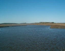
Soil and terrain information is needed for many interpretations for example in the field of agriculture, environment, watershed management, infrastructure, etc. but available data are often inaccessible, incomplete, or out of date. The Group on Earth Observations - GEO plans a Global Earth Observing System and, within this framework, the e-SOTER project addresses the felt need for a global soil and terrain database. As the European contribution to a Global Soil Observing System, it will deliver a web-based regional pilot platform with data, methodologies, and applications, using remote sensing to validate, augment and extend existing data.
The project e-SOTER is a collaborative research project of 14 partners in Europe, China and Morocco, with European Union funding through the FP7 mechanism.
The e-SOTER project is funded by EU's Seventh Framework Programme (FP7).
| Project number | n/a | ||
|---|---|---|---|
| Subject(s) | AGRICULTURE , HYDRAULICS - HYDROLOGY , INFORMATION - COMPUTER SCIENCES , INFRASTRUCTURES , MEASUREMENTS AND INSTRUMENTATION , METHTODOLOGY - STATISTICS - DECISION AID , NATURAL MEDIUM , POLICY-WATER POLICY AND WATER MANAGEMENT , PREVENTION AND NUISANCES POLLUTION , RISKS AND CLIMATOLOGY , TOOL TERMS | ||
| Acronym | e-SOTER | ||
| Geographical coverage | Czech Republic, Netherlands, Hungary, Germany, Italy, United Kingdom, Netherlands, France, China, Morocco | ||
| Budget (in €) | 0 | ||
| Programme | FP7 INCO | ||
| Web site | http://www.esoter.net | ||
| Objectives | Soil and land information is needed for policy-making, hands-on management of land resources, and monitoring of the environmental impact of development. Lack of comprehensive information about land resources - globally, nationally or locally - means uninformed policies, continuing degradation of land and water resources, unnecessary carbon emissions to the atmosphere, and no likelihood of achieving the United Nations Millennium Development Goals. The viability and cost of vital infrastructure is affected just as much as food and water security and response to environmental change. In the case of the European Soil Thematic Strategy, the operational measures laid down in the Framework Directive and Impact Assessment are hamstrung by lack of accessible, easy-to-use, consistent, harmonized and relevant soil data. Present situationThe only harmonized global soil information is the FAO-Unesco Soil Map of the World at scale 1:5 million (FAO-Unesco 1974-1981); for Europe, the 1986 Soil map of the European Communities at scale 1:1 million (CEC 1985) is supported by the Soil geographical database for Eurasia and the Mediterranean (Lambert et al. 2002). A much-improved methodology for a World Soil and Terrain database (SOTER) incorporates quantitative information on both soils and terrain (van Engelen and Wen 1995). Figure 1 depicts the present status of SOTER compilation. Figure 2 illustrates the SOTER attribute data model that can contain up to 118 unique attributes of a soil and terrain unit. e-SOTER adds value by:
The project addresses four major barriers to a comprehensive soil observing system:
|
||
| Results | Methodology and work planWe will organize the research in a sequence of data collection, transformation, data management, interpretations and delivery. Under transformation there are two parallel thrusts that differ in scale, methodology and tools:
WP 2: development of a methodology to integrate soil data from legacy and remote sensing sources WP 3: improvement of the SOTER spatial and attribute data WP 4: accuracy assessment of terrain and soil platforms WP 5: applications WP 6: development of an e-SOTER dissemination platform WP 7: stakeholder conferences WP 8: project management |
||
| Period | [01/09/2008 - 29/02/2012] | ||
