 you are not logged in


![]()
![]()
![]()
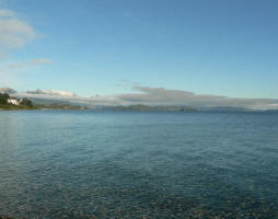
 Amid widespread droughts and crop failures, satellites could help prevent famines
The Normalized Difference Vegetation Index (NDVI) is an innovative combination of two satellite measurements that allows scientists to analyze changes in the "greenness" of Earth as viewed from space. The system itself goes back to the 1980's, however, its association with new satellite-based technology nowadays is proving to be particularly useful in some of the world's most contentious hotspots.
In 2008, the U.S. Agency for International Development's Famine Early Warning Systems Network (FEWS NET) and a number of other partners used NDVI to monitor wheat yields in Iraq and Afghanistan through a persistent drought that led to the worst yields in a decade.
Satellite data alone cannot cure the world of famine, Brown notes, but systems like FEWS NET can buy critical time for governments and relief organizations to react when droughts, wars, and infestations strike the food supply.
Currently the best data for NDVI measurements come from the Moderate Resolution Imaging Spectroradiometer (MODIS) instruments on NASA's Terra and Aqua satellites; earlier data came from the Advanced Very High Resolution Radiometer (AVHRR) instruments deployed on NOAA polar orbiting meteorological satellites.
On Tucker's maps, the sparsely vegetated areas of the Sahara and the Sahel region have NDVI values near zero. The dense jungles of Central Africa have an NDVI closer to 1, the highest value.
Related Links:
› Measuring Vegetation (NDVI & EVI)
› Global Inventory Modeling & Mapping Studies
› Science Magazine Cover
› African Land-Cover Classification Using Satellite Data
› Precision Farming
› Drought Threatens Africa
| Contact information |
Adam Voiland, NASA's Goddard Space Flight Center
|
|---|---|
| News type | Inbrief |
| File link |
http://www.nasa.gov/topics/earth/features/obscure_data.html |
| Source of information | UN-SPIDER Newsletter from NASA |
| Keyword(s) | drought, satellite data, NDVI, MODIS, AVHRR |
| Subject(s) | MEASUREMENTS AND INSTRUMENTATION , METHTODOLOGY - STATISTICS - DECISION AID , NATURAL MEDIUM , RISKS AND CLIMATOLOGY |
| Relation | http://www.semide.org/topics/fol573816 |
| Geographical coverage | International |
| News date | 05/10/2009 |
| Working language(s) | ENGLISH |
