 you are not logged in


![]()
![]()
![]()
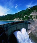
 Earth Observation satellites help rescue operations after heavy floods
During the months of July and August 2010, heavy rains hit numerous regions over the world, the northern Pakistan being the most devastated, followed by some EU countries, namely Bulgaria and the Czech Republic. In the framework of both the International Charter Space and Major Disasters and GMES, data from a range of Earth Observation satellites have been used to generate essential maps of the flooded areas in order to support rescue operations on the ground. Radar imagery was acquired by the Envisat's 'ASAR' instrument, as well as optical imagery by the Envisat's 'MERIS' instrument and the French Spot 5.
Furthermore, the German TanDEM-X has provided its first crisis assistance, while the ESA’s SMOS mission acquired data of the water content in the soils of the affected area, both through interferometric techniques.
| Contact information | n/a |
|---|---|
| News type | Inbrief |
| File link |
http://www.gmes.info/pages-secondaires/news/news-detail/?tx_ttnews[tt_news]=324&tx_ttnews[backPid]=808&cHash=5c611b6c2e259c1afecd28248a73ad0f |
| Source of information | ESA |
| Keyword(s) | earth observations, floods |
| Subject(s) | HYDRAULICS - HYDROLOGY , INFORMATION - COMPUTER SCIENCES , METHTODOLOGY - STATISTICS - DECISION AID , NATURAL MEDIUM , PREVENTION AND NUISANCES POLLUTION , RISKS AND CLIMATOLOGY |
| Relation | http://www.semide.org/topics/fol573816 |
| Geographical coverage | Bulgaria, Czech Republic, Pakistan, |
| News date | 01/10/2010 |
| Working language(s) | ENGLISH |
