 you are not logged in


![]()
![]()
![]()
 Satellite-based Wetland Observation Service (SWOS) project launch
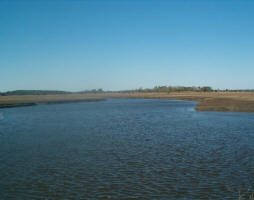
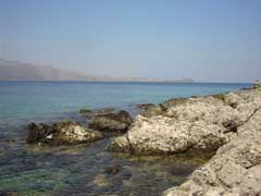
The kick off meeting of Satellite-based Wetland Observation Service (SWOS) project took place in Jena (Germany) on July 1-2nd, 2015. The Satellite-based Wetland Observation Service (SWOS) project is co-funded by Research and Innovation H2020 programme for 3 years and is involving 13 partners.
The main objective is to develop a monitoring and information service focussing on wetland ecosystems. The partners started working on the selection of test sites, their characterisation and products that will be derived from satellites data. A wide variety of wetlands areas will be studied in some cases in combination with the entire river basin to analyse the contribution of these areas to water management.
In the Mediterranean area, the coverage should include sites in Spain, France, Italy, Greece, Slovenia, Montenegro/Albania, Morocco, Algeria, Egypt, Jordan and Tunisia. Service cases will be developed focusing on the key policy issues of each area.
The types of product foreseen are: land cover/land use (and their changes), inventory/delineation, soil moisture, land surface temperature, water quality and surface water dynamic. A strong focus will be on end-users engagement through dedicated workshops, field visits, training and direct access to the services.
Collaboration has been initiated with GEO BON (Biodiversity Observation Network) and with the 2nd project selected under the same H2020 call: EcoPotential.
--
SWOS Objectives

| Contact information |
Kathrin Weise Optical Instruments - Project Manager Jena-Optronik GmbH Otto-Eppenstein-Strasse 3 07745 Jena Germany
(email: kathrin.weise@jena-optronik.de) Phone: +49/ (0)3641/ 200160 mobile: +49/ (0)171 / 2939624 fax.: +49/ (0)3641/ 200220 |
|---|---|
| News type | Inbrief |
| File link |
http://www.swos-service.eu/ |
| Source of information | Jena-Optronik GmbH |
| Keyword(s) | wetlands, satellite data, observation, SWOS, biodiversity, geo, H2020, soil moisture, land surface temperature, water quality, LST, NDVI, evapotranspiration, land cover, land use, delineation |
| Subject(s) | ANALYSIS AND TESTS , CHARACTERISTICAL PARAMETERS OF WATERS AND SLUDGES , HYDRAULICS - HYDROLOGY , INFORMATION - COMPUTER SCIENCES , INFRASTRUCTURES , MEASUREMENTS AND INSTRUMENTATION , METHTODOLOGY - STATISTICS - DECISION AID , NATURAL MEDIUM , PREVENTION AND NUISANCES POLLUTION , RISKS AND CLIMATOLOGY , TOOL TERMS , TOURISM - SPORT - HOBBIES , WATER QUALITY |
| Relation | http://www.emwis.net/thematicdirs/events/2015/07/satellite-based-wetland-observation-service-swos-project-kick-meeting/ |
| Geographical coverage | Germany,Spain,France,Italy,Greece,Slovenia,Montenegro,Albania,Morocco,Algeria,Egypt,Jordan,Tunisia,Netherlands, |
| News date | 24/08/2015 |
| Working language(s) | ENGLISH |
